Moore's Gully
Key Facts
• Flood mitigation solution through improved conveyance of flood waters
• Improved commercial and environmental outcomes
Project Data
Location: Trinity Beach, Cairns, Queensland, Australia
Year Completed: 2010
Site Area: 180ha development for residential subdivision
OVERVIEW
The Bluewater development site is located adjacent to the Captain Cook Highway between Reed Road and Trinity Beach Road some 15kms north of Cairns. The 180 hectare site extends from Captain Cook Highway to the steep slopes of Earl Hill and incorporates the low lying Moore’s Gully floodplain. Moore’s Gully catchment size is 730ha resulting in flows of 150m3/sec in the 100yr ARI event.
The management of Moore’s Gully was a major consideration in the Master Planning of the site. The extensive flood plain not only impacted on the available development footprint but also affected significant areas of Trinity Park and Trinity Beach in relatively low recurrence interval rainfall events.
A review of Moore’s Gully identified a new opportunity to achieve an improved conveyance solution to deal with flood flows in lieu of the proposal adopted by a previous consultant that comprised a 10ha lake and major flood retention/detention system. The new concept required modification of the Moore’s Gully alignment and profile (in particular, overbank works) to provide improved conveyance capacity of the waterway to achieve acceptable flood immunity to the development and improved flood immunity to surrounding land owners (at Trinity Beach and Trinity Park) with acceptable/tolerable impacts.
The project was influenced by a diverse range of stakeholders with particular requirements, including various levels of Government, in an environmentally sensitive and difficult area. It is recognised as a good example of environmentally sustainable development in waterways, addressing and correcting unsustainable practices of the past and setting the scene for future sustainable development and community resilience to climate change.
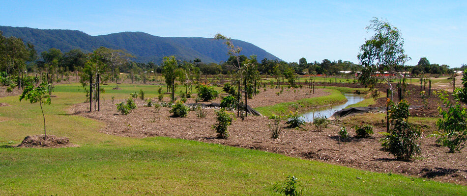
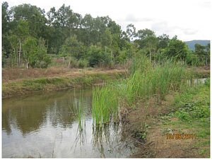
Moore’s Gully has now become a multi-functional corridor providing passive recreational facilities, increased ecological diversity and habitats and the integration with the urban constraints such as roads, cycle and pedestrian paths.
Awards: Engineers Australia, Cairns region, Project of the Year 2010
PLANNING AND MANAGEMENT
The management of Moore’s Gully presented the major constraint for Master Planning the development potential of the Bluewater residential subdivision site. Hydraulic modelling, a review of the hydrology for the catchment and modelling appropriate flood mitigation and flood conveyance solutions for the site were undertaken. Through these investigations it was identified that a flood conveyance and stream rationalisation solution was viable for the site in lieu of the previous design which indicated the inclusion of a 10 ha lake and major flood retention system.
The design proceeded with the waterway re-aligned and regraded in the upper sections through the development site. This provided a positive outlet for the existing drainage networks servicing the urban areas of Trinity Beach abutting the Bluewater development. The lower sections were re-profiled, in particular overbank works, which increased the waterway area and, in turn, the conveyance capacity of the gully. Minimal impact occurred to the properties downstream which were shown in the hydraulic modelling.
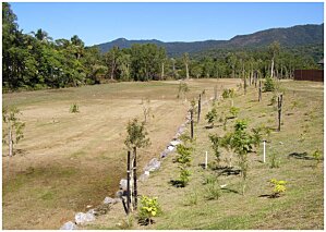 Extensive liaison with the relevant agencies (Cairns Regional Council [CRC], the then Department of Natural Resources and Water [DNRW] and Environmental Protection Authority [EPA]) was undertaken to introduce the proposal, explain the philosophy of maintaining and enhancing existing environmental values, explain the catchment approach to the management of Moore’s Gully, identify opportunities to provide significant flood immunity benefits to surrounding landowners and to identify any issues that required further consideration.
To ensure that the landscaping is fully established and the site secure, the Developer agreed to an extended maintenance period of three years.
SITE
The lower reaches of the watercourse through the Moore’s Gully site lies within a Marine Zone (prescribed tidal works area) which limited the scope of works that could be undertaken downstream.
The scope of the remodelling works extended from the existing culverts at Roberts Drive to the downstream end of the concrete channel located on Council land, a length of some 2.3km. Earthworks volume was in the order of 140,000 cubic metres with all suitable material used as fill on future stages of the development (Stages 1B, 5, 7 & 8 on the eastern side of Moore’s Gully and the balance placed and compacted on land to be developed to the west).
During these earthworks activities approximately 6,000 cubic metres of Potential Acid Sulphate Soils (PASS) material was removed from site as it was not suitable for treatment and re-use. In addition, some 24,000 cubic metres of PASS material was exported to treatment pads located to the west of the watercourse and treated with lime. This material was then placed and compacted on the future development site.
The pre-development watercourse was highly disturbed after many decades of sugar cane farming. Subsequently the site was used for quarrying sand. More recently, the area has served as a spoil site for Potential Acid Sulphate Soils (PASS) from the nearby marina land development. It is understood that in the early stages as a spoil site, the original quarry was used as a deep burial pit for PASS material. Later stages saw surface stockpiling of the PASS material occurring which led to a series of bunds and stilling basins being constructed to control and manage acid leaching.
DESIGN
 The original design approach for the treatment of Moore’s Gully through the Bluewater site involved the construction of a 10 ha lake and a major flood retention system. While lake systems work effectively in areas such as the Gold Coast in temperate Australia, they do not achieve the same results in Tropical North Queensland. This is due to weather patterns where the majority of the very high rainfall events occur over a relatively short time of the year (the wet season).
It was identified that the retention (lake) solution had unacceptable impacts on the existing Moore’s Gully and did not provide an opportunity for the mitigation of existing flooding problems at Trinity Beach and Trinity Park.
A major Services Corridor, protected by an easement, traverses the site of Moore’s Gully and contains a 600/750mm diameter trunk sewer pressure main, a 600mm diameter water distribution main and optic fibre telecommunication cables. The potential for realigning the waterway to cross the services corridor or re-profile the floodplain was limited by the surface levels over these services. The expense and disruption resulting from the relocation of these services meant that every effort was made to minimise conflict with the services.
These shortcomings in the original proposal were recognised by Flanagan Consulting Group who, with the support of the developer, sought an alternate conveyance solution which offered benefits to the development while also improving the flood immunity for Trinity Beach and Trinity Park properties.
A detailed review of the site constraints was established. This included fixed constraints such as the service corridor, deep buried dredge spoil and areas of environmental significance and other constraints such as access locations, services capacity and location, flooding and drainage. All of this information was then integrated into a documented constraints map. The constraints map provided an input into the preparation of a master development layout for the balance area of the site to determine the optimum solution in terms of development yield, estimated cost, efficient use of land, acceptance by Approval Agencies etc. Of particular concern was the issue of the fauna corridor and the riparian values of the section of Moore’s Gully between the tidal areas and the existing Trinity Beach Road crossing. This needed to be addressed in order to establish some certainty of outcomes for any approval processes through the Department of Environmental Resource and Management (then existing as the Department of Natural Resources and Water and Environmental Protection Authority).
The constraints analysis and master design led to significant project savings. It is considered that a broader strategic approach should be applied based on maximising client outcomes through a client focussed project approach rather than a narrow technical consideration.
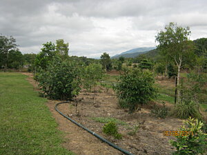
The extensive landscape and revegetation of all disturbed areas was achieved in close consultation with the Department of Natural Resources and Water. Conics (now RPS) prepared landscape plans which were incorporated into the Contract Works with LDI Constructions. The revegetation works included the planting of some 30,000 native trees, creating a new environmentally sustainable waterway environment offering the community improved passive recreational facilities along the waterway corridor.
MATERIALS
A separate contract was undertaken to remove the Actual and Potential Acid Sulphate Soils (AASS/PASS) material previously stockpiled on the site. AASS/PASS material was removed to the treatment pads west of Moore’s Gully where the material was dried, treated with lime and mixed prior to being transported back as structural fill material in the future development areas. The majority of these works were completed prior to the Moore’s Gully flood mitigation works but provision was made for the removal and treatment of PASS material during the remodelling of Moore’s Gully.
Revegetation works included the placement of TEC Mat Coir TMC7 in areas of high flow velocities to assist in the short term establishment of the site. Hydroseeding and grass sprigging was undertaken on all disturbed areas and some 30,000 native trees (in 140mm and 45L containers) were planted, irrigated and maintained.
The majority of materials supplied for construction were sourced from local suppliers and quarries.
ENERGY
 The modification of the Moore’s Gully alignment removed the significant cost (approximate cost $5M) and energy use of the construction of the lake and flood retention/detention structure. It resulted in significant earthworks savings including machinery energy costs for the development, minimised ongoing tenure, and maintenance and operating cost issues including energy costs for the Lake and reduced the area of land constrained for dealing with hydraulic issues and its associated energy costs.
The area of land available for residential development was increased although required less energy to produce the increased lot yield, a win-win outcome for the environment and developer.
WATER and WASTE
By investigating an alternate solution to the usual detention mitigation measures and adopting a conveyance solution for flood mitigation, the resultant waterway has become a multi-functional Urban Ecological Corridor.
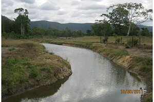
Improved water quality is also achieved through the re-alignment and re-profiling of the waterway. The design philosophy adopted for the realignment reflected that of a natural stream with the design incorporating sinuosity, low velocities, and minimising engineered scour protection works by focussing on landscaped revegetation for scour protection.
CLIENT/ USERS STATEMENT
The following commendation was received from Errol Colman, Leader Water Resource Management of the Department of Environment and Resource Management following the completion of construction:
“Last week I inspected the works on the Multiplex Bluewater site that have been authorised by the department under a riverine protection permit and the licence to interfere by diversion after they have sustained flows from a single wet season. I would like to congratulate Multiplex, Flanagan Consulting Group and any other contractors and subcontractors on some of the excellent work carried out up to this point particularly the compliance in almost all respects with the approvals that have been issued by DERM and by achieving healthy grass cover and revegetation with trees and stable civil works. The Department recognises this was achieved despite the delays and glitches (including re- advertising) that occurred along the way. It is a credit to all involved in the circumstances. I was most impressed that I observed almost nil erosion except for a couple of localised spots - and quite frankly these were much less than I expected to see on a job of this size and complexity, and with major raw works that had reshaped a creek confronting their first wet season.”
PROJECT TEAM
Civil Engineer and Designer: Flanagan Consulting Group
Contract Managers: Flanagan Consulting Group
Landscape Architect: RPS Group
Flood Mitigation Consultant: Brown Consulting (Qld) Pty Ltd
Project manager: LDI Constructions (Qld) Pty Ltd
Geotechnical Consultants: Golder Associates
Erosion Consultant: NRA Environmental Consultants
Civil Contractor: LDI Constructions (Qld) Pty Ltd

